
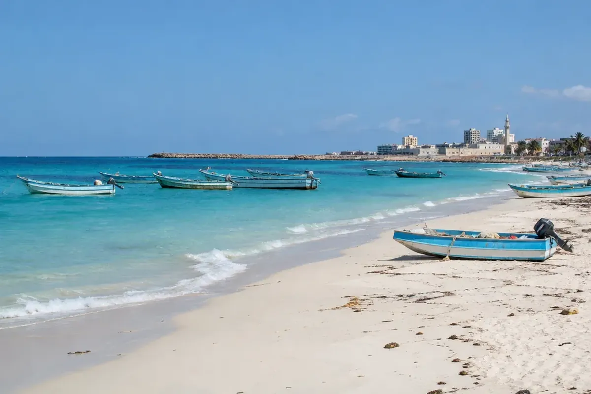
Somalia is located in the Horn of Africa, at the easternmost edge of continental Africa. From just south of the Equator, its land extends north toward the Gulf of Aden, facing the Arabian Peninsula across the water. In that position, Somalia has an unusually long shore on the Indian Ocean and sits at a geographic meeting point between eastern Africa and Arabia.
Where Is Somalia Located in Africa?
Geographically, Somalia lies roughly between 2° south and 12° north latitude, so its southern tip crosses into the Southern Hemisphere. To the north is the Gulf of Aden; to the east is the Indian Ocean. Across the Guardafui Channel lies Yemen’s island of Socotra.
On land, Somalia is bordered by Ethiopia to the west, Kenya to the southwest, and Djibouti to the northwest. At the tip of the Horn of Africa sits Cape Guardafui, in Puntland.
A Somalia Map in Words: Borders, Coastline, and Scale
| Feature | What it shows |
|---|---|
| Land area | 637,657 square kilometers—slightly smaller than Texas and slightly larger than France. |
| Land borders | About 2,385 kilometers shared with Ethiopia, Kenya, and Djibouti. |
| Coastline | About 3,333 kilometers along the Gulf of Aden and Indian Ocean, the longest of any mainland African country. |
| Eastern points | Cape Guardafui and Ras Hafun, the latter the easternmost point of the African continent. |
Beyond the coast, most terrain is plateau, plain, or highland. In the north, the Karkaar Mountains rise while river valleys mark the south. At 2,460 meters, Mount Shimbiris in the Karkaar range is the highest point.
Why Rainfall and Rivers Matter So Much
Across much of Somalia, the climate is semi-arid to arid. In the arid northeast, long-term average annual rainfall is below 100 millimeters, compared with 500 to 600 millimeters in the southwest and northwest. Just about 1.6 percent of the land is arable.
From April to June, the gu rains provide the main rainy season, followed by the dayr rains from October to December. From December to March comes jilaal, the harshest dry season; xagaa runs from June to September.
In river systems, the Jubba and Shabeelle are the country’s only permanent rivers, both rising in the Ethiopian highlands. Along the northern Gulf of Aden coast, the narrow Guban plain broadens near Berbera.
Mogadishu Is the Capital and Largest City
On the Indian Ocean coast just north of the Equator is Mogadishu, also called Muqdisho, Somalia’s capital and largest city, with an estimated 2.7 million residents. Since the 10th century, it has been a major seaport. It was one of the earliest Arab trading settlements on the East African coast, dating back to the 900s CE.
Beyond the capital, important places in Somalia include Hargeisa, the capital of the self-declared Republic of Somaliland; Kismayo, a southern port; Bosaso, a commercial hub in Puntland; and Garowe, Puntland’s administrative capital.
Somaliland and Puntland Have Different Political Roles
In the territory formerly known as British Somaliland, Somaliland declared independence from Somalia on May 18, 1991. Its own government, Somaliland shilling, and elections following a 2001 constitutional referendum set it apart administratively. Yet no United Nations member state has recognized it as an independent country.
By contrast, Puntland took a different path. On August 1, 1998, it declared itself an autonomous federal member state rather than seeking independence. Garowe is its capital, and its territory includes Cape Guardafui and Ras Hafun. Between Somaliland and Puntland, the regions of Sool, Sanaag, and Ayn are disputed, with occasional armed clashes.
When reading a map, these distinctions are essential: Somaliland’s self-declared status and Puntland’s autonomy do not mean that Somalia has ceased to be a sovereign state.
Somali, Arabic, and a Predominantly Muslim Society
For language, Somali is the national and official language. As an Eastern Cushitic language in the Afroasiatic family, it has used a Latin-based writing system since 1973. In religious practice and formal settings, Arabic—the second official language—is used chiefly. In urban areas, English and Italian are also spoken, reflecting British and Italian colonial history; Swahili is spoken in southern coastal towns.
In religion, more than 99 percent of the population is Sunni Muslim. Somalia is therefore not a Hindu country: only a very small minority follows Hinduism, estimated at about 8,278 people in 2015. Demographically, the country is also among Africa’s most ethnically homogeneous states, with ethnic Somalis comprising about 85 percent of residents.
What Somalia Is Known For Beyond Its Location
Beyond its location, Somalia is known for its maritime position, pastoral economy, and deep trading history. In ancient times, the area was associated with the Land of Punt, a trading partner of Ancient Egypt. Later, the Ajuran, Adal, and Geledi sultanates were among the powers active in regional trade.
After the 1884–85 Berlin Conference, colonial borders drawn by Britain and Italy divided Somali-inhabited lands. On June 26, 1960, British Somaliland became independent; Italian Somaliland followed on July 1, and the two united that day as the Somali Republic. In 1969, Siad Barre seized power and was overthrown in January 1991, after which civil war and state collapse reshaped the country. In August 2012, the Federal Government of Somalia was established.
Economically, livestock remains central, contributing about 40 percent of GDP and more than half of export earnings. In 2024, Somalia exported 3,718,966 animals—sheep, goats, cattle, and camels—mainly to Gulf states. For payment, the Somali shilling is the official currency, though U.S. dollars are widely accepted.
Common Misconceptions About Somalia
- Not a U.S. territory. Somalia is the independent Federal Republic of Somalia. The United States recognizes its territorial integrity within its 1960 borders.
- More than desert. Much is arid, but the country also has mountains, coastal plains, plateaus, and the Jubba and Shabeelle river valleys.
Frequently Asked Questions
Where is Somalia located?
In eastern Africa, Somalia is in the Horn of Africa. Along its land borders are Ethiopia, Kenya, and Djibouti; the Gulf of Aden is to the north and the Indian Ocean to the east.
What is the capital of Somalia?
The capital and largest city is Mogadishu. Just north of the Equator, it is an Indian Ocean port and has been a major seaport since the 10th century.
How big is Somalia?
At 637,657 square kilometers, Somalia is slightly smaller than Texas and slightly larger than France.
Is Somalia a U.S. territory?
No. As an independent sovereign state, Somalia is the Federal Republic of Somalia. The United States does not claim sovereignty over it.
Is it safe to visit Somalia now?
The U.S. State Department warns “Do not travel to Somalia for any reason” because of crime, kidnapping, terrorism, landmines, piracy, and limited medical services. Foreign consular help within the country can also be severely limited.
What languages are spoken in Somalia?
Officially, the languages are Somali and Arabic. Beyond those, English and Italian are also spoken, especially in urban areas, and Swahili is used in southern coastal towns.